Statistics of polar lows around Japan
| A01-K1. Statistics of polar lows around Japan | |
|---|---|
| PI | Wataru YANASE#(Assistant professor, University of Tokyo) |
[Doctral degree: #Meteorology]
During the winter, meso-scale (several hundred kilometers) cyclones develop over the Japan Sea (Fig. 1), which are called "Polar lows." Polar lows generally develop over the high-latitude oceans, and are different from synoptic-scale (more than a thousand kilometers) extratropical cyclones. Their intense wind, heavy snowfall and high waves affect human society significantly. For example, polar lows over the Japan Sea have caused heavy snowfall in the northern areas of Japan, a 6,000-ton vessel disaster (Feb. 1981), and a train disaster (Dec. 1986).
Why do polar lows develop over the high-latitude oceans? During the winter, a cold air mass over a continent blows over the ocean. The air mass is transformed by heat and moisture from the warm ocean, which causes active cumulus convection. The condensational heating within the cumulus convection supplies energy to a polar low. The horizontal temperature difference between the air masses over the cold continent and the warm ocean also provides the energy for polar low development.
Recently, meteorologists study the statistics of polar lows in the present and future climates intensively. They take advantage of the recent progress of high-resolution datasets. The goal of the present study is to investigate the polar low statistics around Japan focusing on the following issues:
- (i) To develop a cyclone tracking algorithm that can objectively detect polar lows in the reanalysis dataset such as JRA-55.
- (ii) To construct a polar low database around Japan using reanalysis datasets and satellite imagery.
- (iii) To clarify the climatology of polar lows including the air-sea interaction and coupling with the upper-tropospheric disturbances.
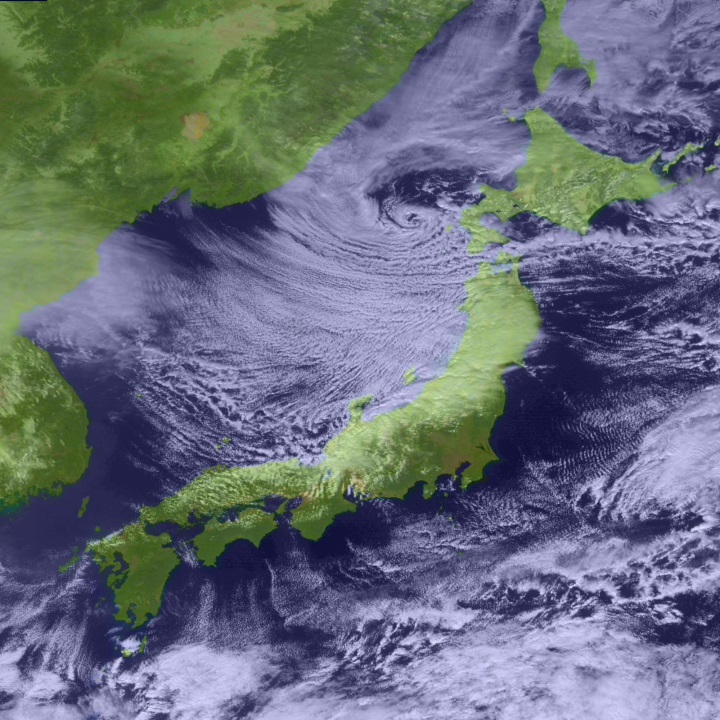
Fig. 1: A visible satellite image at 1200 UTC on 31 January 2012. A polar low with spiral-shaped cloud pattern forms over the northern Japan Sea. The satellite image is obtained from the website of "Kochi University, Weather Home."
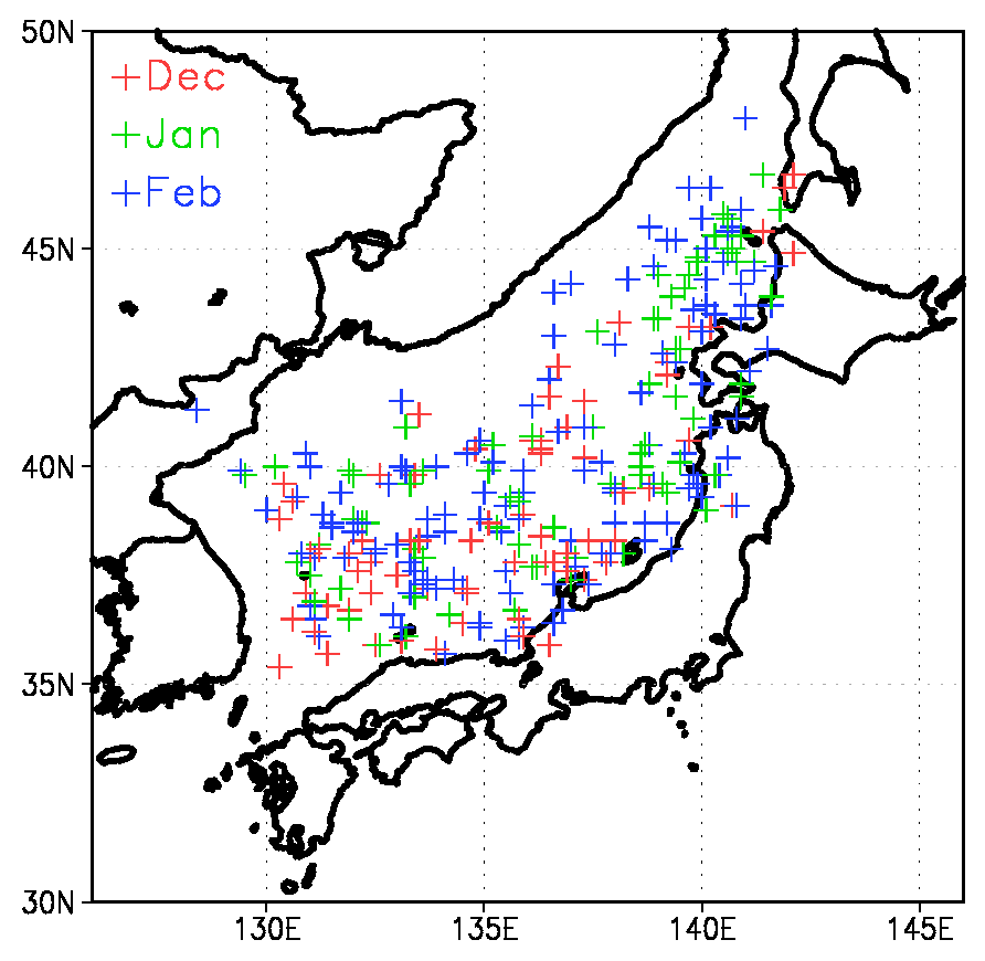
Fig. 2: Geographical distribution of meso-scale vortices, which are candidates of polar lows. The vortices are detected every 6 hours for the 6 winters (Dec-Jan-Feb) from Dec. 1997 to Feb. 2003 using the JMA’s nephanalysis charts.